This walk is a very good one if you are just visiting the area, live in the area and have guests who like walking, or have children. It’s full of variety, and you can get good food en route too.
SUMMARY
- Grade: Moderate – Most of this is relatively easy, but for a good view from the Seven Sisters you will need to have a head for heights. There are a few steep and potentially muddy uphill stretches on the way back.
- Length:4 miles
- Key Features: King Arthur’s cave, Biblins bridge, rapids, ferry over Wye. Views from the top of one or more of the Seven Sisters (depending how high risk you like your views).
- Refreshments: Lower Symonds Yat has various hotels and cafes. We always end up at the Saracens Head, which has great food – and someone from behind the bar will take the ferry over to the other side of the river for you.
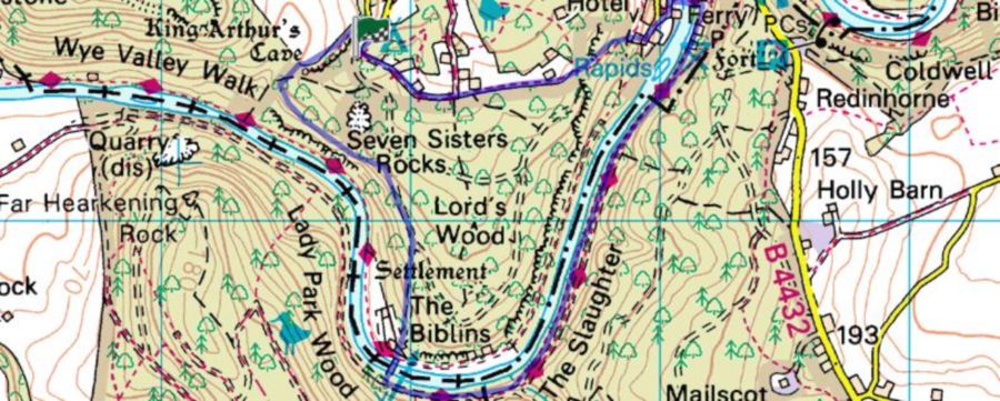
For an interactive version of this map click the image above or here
Route
Park opposite the campsite situated on the Doward, which is about a mile south of the A40 ( at the top of the track leading down to the Scouts’ camping ground at Biblins on the Wye).
Retrace the way you came for about 10 yards, and turn left along the asphalted road for about 50 yards or so. Take the path to the left until you get to a disused quarry in a small clearing. Bear towards the right of this, following the footpath signs. Walk past several outcrops of rock. Towards the end of these outcrops there is a large cave, locally reputed to have been one used by King Arthur.
Return to the trail, and follow the yellow arrows going straight on. 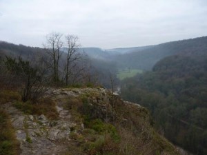 The path goes downhill for a while, and then turn left following signs for the High Meadow trail. You will find yourself on a track which is following the top of a line of high columnar cliffs, called the Seven Sisters. The smaller tracks leading off on the right take you to various viewpoints at the top of the Sisters. From the top, although there are splendid views, it is difficult to see how striking the cliffs are – this is much better appreciated from below, as described in Walk C3.
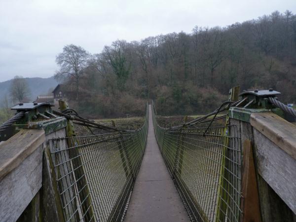
After looking at the views, continue along the path, until you come to a section where several paths converge. At this point you take the path which goes almost straight on uphill. Carry along the path until you reach a track, where you go right, down to the Biblins campsite. Here you take the wooden bridge over the river, and follow the walking/cycling track on the left ( there are also smaller paths nearer to the river) until you reach the hostelries at the bottom of the Symonds Yat cliff.
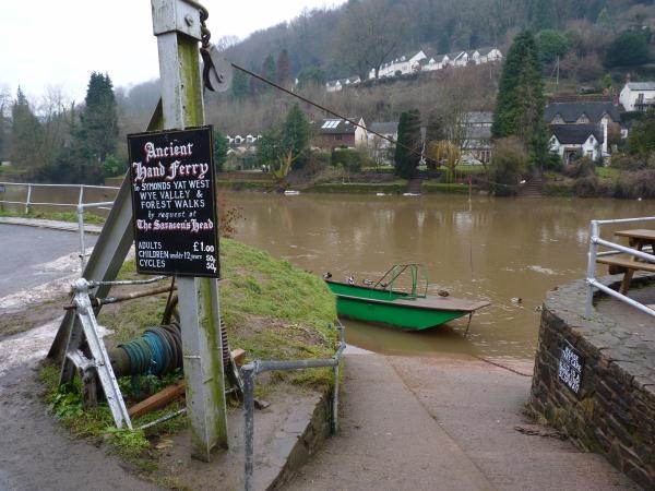
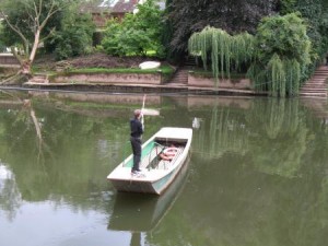 When you’ve refreshed yourself, it’s time to get the ferry over the river. You will need to ask in the bar of the Saracens Head if one of their staff is available to take you over.
Get off the ferry, go up the steps, turn left in front of a white cottage with a brieze block wall behind the cottage’s car parking space. A small path goes steeply upwards on your right at the end of the wall, and you can take this as a shortcut up to the next bend in the road. Go right along the road, past Wye Rapid Cottages and on your left there is a small, box like substation. Immediately beyond that a small footpath again goes uphill. Take this, until you reach a larger footpath where you go left.
Where this branches, take the right hand branch up the hill. Continue along this, and when you come to some old fenced off mine workings, continue straight on keeping the workings on your right hand side, and follow signs for the High Meadow trail. When you get to a section where the track curves gently to the left and goes downhill, there is a sign pointing to the right and you follow this along a path through the woods.
When you come across a larger path at right angles to the direction you’re walking in, bear left and then almost immediately right along another small path. Follow the yellow arrows, until you get to a fork in the path with a wooden post in the middle of the fork and a yellow arrow pointing left. Here you want to go right, and you’ll come out eventually onto a hard track where you go right, up a slope, and you will find your car on the left opposite the campsite.
The walk
I have to admit that the first time we did the walk for this blog, we were thwarted because in the winter of 2011 the river had frozen in places and then thawed, so the ferry couldn’t get across without the risk of being rammed by an ice floe.
Anyway – on most occasions this is a very satisfying walk, best done in the company of other people. It’s also a very good walk to go on with children, with plenty of adventurous sections – although you will need to hang on to them at the top of the cliffs. You too will need a head for heights and will need to take car, if you want to venture out for enough on to the outcrops to make the most of views.
The wooden bridge at Biblins is either enjoyed or disliked by most people – the dislike because of the sway that is created particularly if there are several other people on the bridge at the same time. Dogs can be wary of this too.
Walking along the river towards the bottom of Symonds Yat, takes you past rapids where learner canoeists are doing their best not to fall into the river. It’s always a good idea to try and arrive at the lower Symonds Yat area around either lunchtime (or tea time in the summer). Our favourite eating place, along with many other people, is the Saracen’s Head. The food is superb, and somehow the pub seems able to maintain its quality despite the large number of people eating, particularly at weekends in the summer. When we tried to go to the pub in the winter of 2000, the river had risen so high that the pleasure boats you will see moored up, had been carried almost up to the door of the pub.
The ferry also maintains an important tradition on this part of Wye, and adds a last bit of adventure to the walk – apart from trying to follow the route through the woods back to where you left your car.


 Wye Walker