
 Wye Walker
 This page contains a summary and map of the walk. Full route details and description will be added as soon as I’ve got time!
This is a short a circular walk through the village of Tintern, and then steeply upwards to the woods of Botany Bay, returning along the high slopes above Tintern. It ends by descending into the steep slash of the Angiddy Valley where furnaces used to rage to smelt iron, copper and lead, and water power was used for the first time in Britain to power wireworks.
SUMMARY
- Grade: Easy-Moderate.
- Length: 3 miles
- Key Features: Ruins of the wireworks factory; the mysteriously named Botany Bay and Barbadoes; views northward along the Wye Valley; a descent into the industrial powerhouse of the Angiddy valley
- Refreshments: Tintern
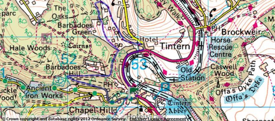
For an interactive version of this map click the image above or here